How to Use Depth Contours for Sailing or Cruising
Did you know that you can use depth curves for safer sailing navigation anywhere in the world? Or that a tried and proven method to find your way home in pea-soup fog has been used for well over 100 years?
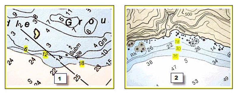
Look over any nautical chart or chart plotter software and you will note curved lines or enclosed circles. These depth contours show areas of equal depth. Check along the line or circle for a break that shows a number (see illustrations 1 and 2).
Contour Line Secrets
Depths along contour lines are often written in numbers divisible by 6 on US charts that show feet or fathoms (numbers divisible by 5 are used on International charts that show meters along the curve). For example, the line closest to shore might be 6 feet, the next line 12 feet, the next 18 feet, and so forth (illustration 1). But never assume that contour lines follow a consecutive pattern of 6 foot increments.
Note in illustration 2 how the contour lines jump from 18 feet to 30 feet to 36 feet. Study your navigational chart to decipher the depth information.