
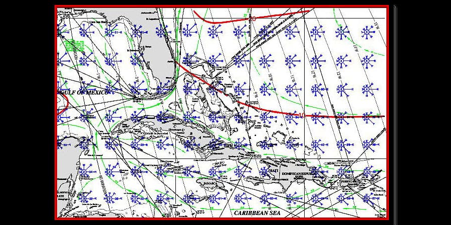
What sailing tool do you have at your fingertips that can help you forecast winds and currents, avoid gales and storms, and find the fastest route for sailing safety? It’s FREE, requires no electrical power and has been “sea tested” for over 100 years!
What super sailing resource can you use when planning a long distance cruise? Enter the Pilot Chart! Each Pilot Chart Atlas covers a specific ocean basin or portion of the basin for each month of the year. Individual Atlases include the North Atlantic (includes the Gulf of Mexico), South Atlantic, North Pacific, South Pacific, and the Indian Ocean.
Take a look at these ten top benefits you receive for free…
- Find the fairest winds for coastal or offshore sailing.
- Locate the best ocean currents for faster passages.
- Forecast sailing wind direction and speed fast and easy.
- Avoid areas frequented by gales, storms, and heavy seas.
- Shape your sailing course to stay away from major shipping routes.
- Check magnetic variation at-a-glance with pre-plotted “isogonic lines”.
- Cast off for cruising or sailing in the safest months of the year.
- Increase your sailing crew’s comfort for safer, easier passages.
- Access a wealth of free information with any PC or mobile device.
- Plan your cruise with a respected, reliable, sea-tested resource.